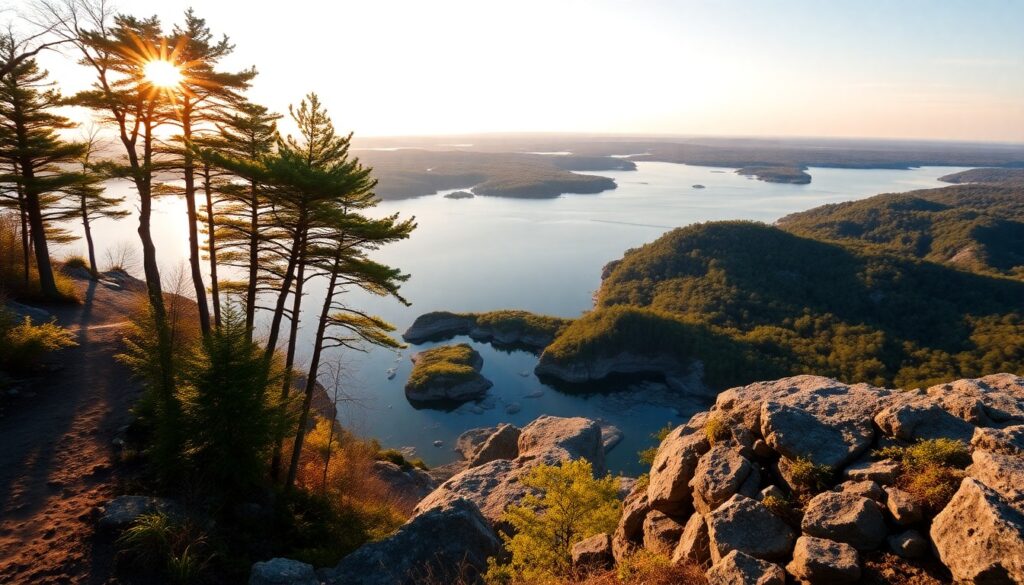
The crisp, briny air washes over you as you step onto the wide carriage path, the rhythmic lapping of water against the shore providing a soothing soundtrack to your adventure. Ahead, the gentle slopes of ancient drumlins rise, crowned with a verdant canopy, beckoning you to ascend and discover the breathtaking vistas beyond. This is the unforgettable introduction to the World’s End Harbour Loop, a jewel on the South Shore of Massachusetts, where meticulously designed landscapes meet raw coastal beauty, offering panoramic views of the Boston skyline and the shimmering expanse of Hingham Harbor.
Trail Specifications
Trail Name: World’s End Harbour Loop
Location: Hingham, MA
Distance: Approximately 4.5 miles (main loop with extensions)
Elevation Gain: ~150 feet
Difficulty: Easy to Moderate
GPS Coordinates (Parking): 42.2470° N, 70.8840° W
Best Season: Year-round, each season offers unique charm
Dog-Friendly: Yes, on leash
Route Overview & Natural Highlights
The World’s End property, a scenic peninsula jutting into Hingham Bay, is a masterwork of natural preservation and thoughtful design. Originally envisioned by famed landscape architect Frederick Law Olmsted (the genius behind Boston’s Emerald Necklace and New York’s Central Park) as a residential park, it now serves as a protected sanctuary managed by The Trustees of Reservations. The terrain is characterized by two prominent drumlins – elongated, teardrop-shaped hills formed by glacial movement during the last ice age – which provide the moderate elevation gain and spectacular viewpoints.
As you traverse the wide, gravel carriage paths, you’ll pass through diverse ecological zones. Mature woodlands, dominated by stately red oaks and fragrant red cedars, give way to open meadows dotted with wildflowers in warmer months. Along the coast, you’ll encounter salt marshes, vital ecosystems brimming with cordgrass and glasswort, serving as critical habitats for various shorebirds like sandpipers and oystercatchers. Keep an eye skyward for osprey diving for fish in the harbor or soaring red-tailed hawks. The geological story of World’s End is etched into its landscape, from the glacial till composing the drumlins to the rocky shorelines composed of ancient metamorphic and igneous rocks, testament to millennia of geological forces.
The true payoff of the World’s End Harbour Loop lies in its unparalleled vistas. From the crests of the drumlins, you’re treated to sweeping, unobstructed panoramas that include the distant Boston skyline, the scattered emerald gems of the Boston Harbor Islands National and State Park, and the bustling activity of Hingham Harbor. These ever-changing scenes ensure that every visit, regardless of the season or time of day, offers a fresh perspective on this stunning coastal landscape.
Turn-by-Turn Trail Breakdown
Trailhead Start: The Olmsted Entrance
Your journey begins at the main entrance, where you’ll find ample parking and a visitor kiosk. From here, follow the main carriage path, a wide, well-maintained gravel surface that immediately immerses you in Olmsted’s vision. You’ll pass through a grove of mature trees, their branches often forming a natural archway. The path gently slopes downward, eventually leading you towards the water’s edge and the initial views of Hingham Harbor to your right. This initial segment is relatively flat, allowing you to warm up and absorb the tranquil atmosphere.
Mid-Trail Features: Drumlins and Coastal Paths
As you continue, the loop begins to reveal its iconic features. You’ll encounter the gentle ascent to the first of the two drumlins. The path remains wide, making the climb manageable for most fitness levels. From the top, pause to take in the expansive views across the harbor towards Hull and the distant city. Descending from the drumlin, the trail skirts the coastline, offering intimate views of the salt marsh and tidal flats. You might spot wading birds or the occasional kayaker paddling through the calm waters. The path then curves inland slightly before beginning the gradual climb to the second, slightly higher drumlin, offering an even more impressive panorama that encompasses the full sweep of the Boston Harbor Islands.
Summit/Destination & Return: Panoramic Views and Scenic Descent
Reaching the summit of the second drumlin is your primary destination, rewarding you with the most encompassing views of the entire property and surrounding waters. Take your time here to identify landmarks, perhaps even spotting the historic Hingham Shipyard across the water. From this elevated vantage point, you’ll truly appreciate the strategic beauty of Olmsted’s design. The return journey follows the remaining portion of the loop, gradually descending from the drumlins and winding back towards the entrance. This segment offers different perspectives of the woodlands and meadows you passed earlier, completing the full World’s End experience.
Seasonal Guide & Best Times
- Spring (April – May): Witness the landscape awakening with fresh green foliage and blooming wildflowers. Migratory birds return, filling the air with song. Cooler temperatures make for comfortable hiking.
- Summer (June – August): Enjoy lush green scenery and warm breezes. Ideal for picnics with harbor views. Early mornings or late afternoons are best to avoid peak heat and crowds.
- Autumn (September – November): Experience a spectacular display of fall foliage, particularly from the drumlin summits. The air is crisp, and the light is often magical for photography. This is a popular time, so plan accordingly.
- Winter (December – March): A serene and often solitary experience. Snow-dusted landscapes offer stark beauty, and the leafless trees provide unobstructed views. Dress warmly, as coastal winds can be biting.
Essential Gear & Safety
- Water: Carry ample hydration, especially on warmer days.
- Appropriate Footwear: Sturdy walking shoes or hiking boots are recommended for comfort on varied terrain.
- Sun Protection: Hat, sunglasses, and sunscreen are vital, as much of the trail is exposed.
- Layered Clothing: Coastal weather can change quickly; layers allow you to adapt.
- Trail Map/Navigation: While well-marked, carrying a map or using a GPS app like AllTrails for the World’s End Outer Loop Trail is always a good practice.
Getting There & Parking
World’s End is located at 400 Martins Lane, Hingham, MA. From Boston, take I-93 South to MA-3 South, then follow local roads to Hingham. The property is well-signed. Parking is available on-site, but please note that advance reservations are often required, especially on weekends and holidays, to manage visitor capacity. Check The Trustees of Reservations website (thetrustees.org/place/worlds-end/) for current reservation policies, operating hours, and parking fees. Members of The Trustees typically enjoy free parking, while non-members will incur a fee, which helps support the preservation of this magnificent property.
Curated Literature & Boston Downtown Calendar
The Architecture of Focus: Deep Work & Modern Mastery
By Founders Library Press
A structured framework for strategic clarity, productivity, and authentic execution.
Upcoming Downtown Happenings
Live acoustic sessions, gallery receptions, literary salons, and independent trade shows across Boston.